
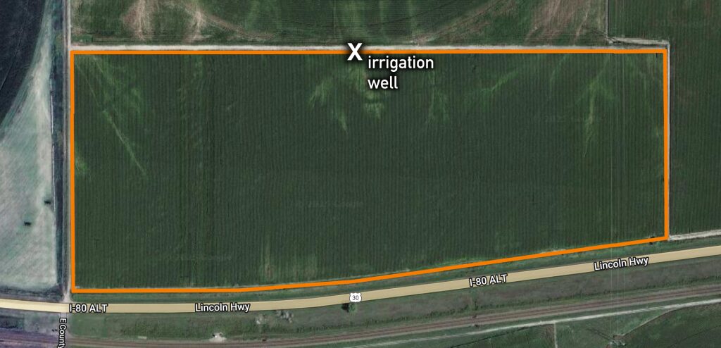
Location:
West of Paxton 1/2 mile
Legal Description:
Lot 7 and the Southeast Quarter of the Southwest Quarter and a tract less the railroad right-of-way in Section 6, Township 13 North, Range 35 West of the 6th P.M., Keith County, Nebraska
About the Land:
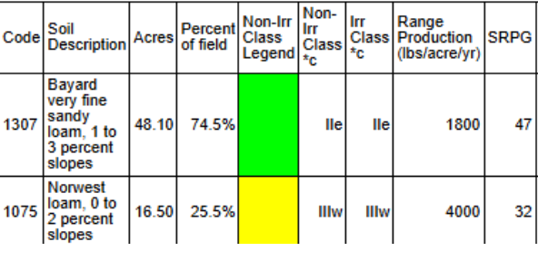
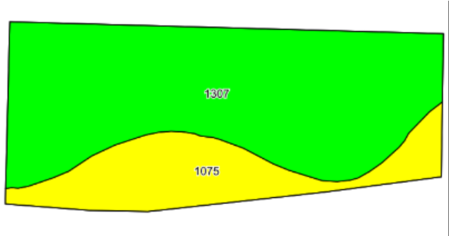
64.9 Acres, more or less, according to Keith County Assessor’s records. This productive Keith County farm offers gravity-irrigated cropland with excellent potential for pivot irrigation. Mostly Class 2 soils. The property is well-suited for row crop production and is well located with easy access from Paxton.
Well Data:
(per registration) G-054363, Feb 1976, 156ft. deep, 25ft. static water level, 78ft. pumping level
Natural Resources District:
The land is located in the Twin Platte NRD and has certified irrigation rights for 60.66 acres.
2024 Taxes:
Real Estate – $ 1,903.84 | Occupation – $ 394.29
Price:
$ 390,000
