Marshall Auction Presents
225.48 acres selling in 2 Tracts in Buffalo County, Nebraska Selling two tracts of exceptionally good quality pivot irrigated cropland with a significant amount of Class 1 & 2 rated soils.
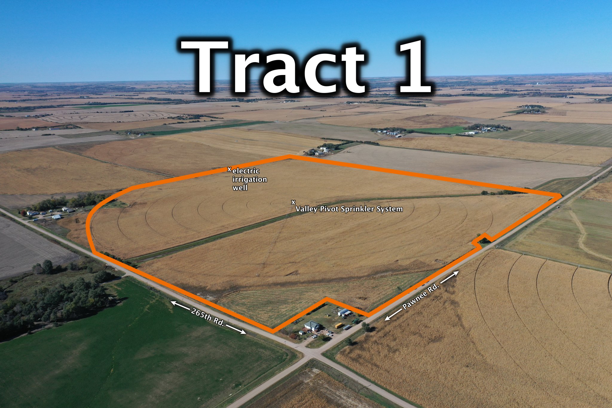
TRACT 1 - 148.45 Acres +/- Buffalo County, Nebraska
TRACT 2 - 77.03 Acres +/- Buffalo County, Nebraska
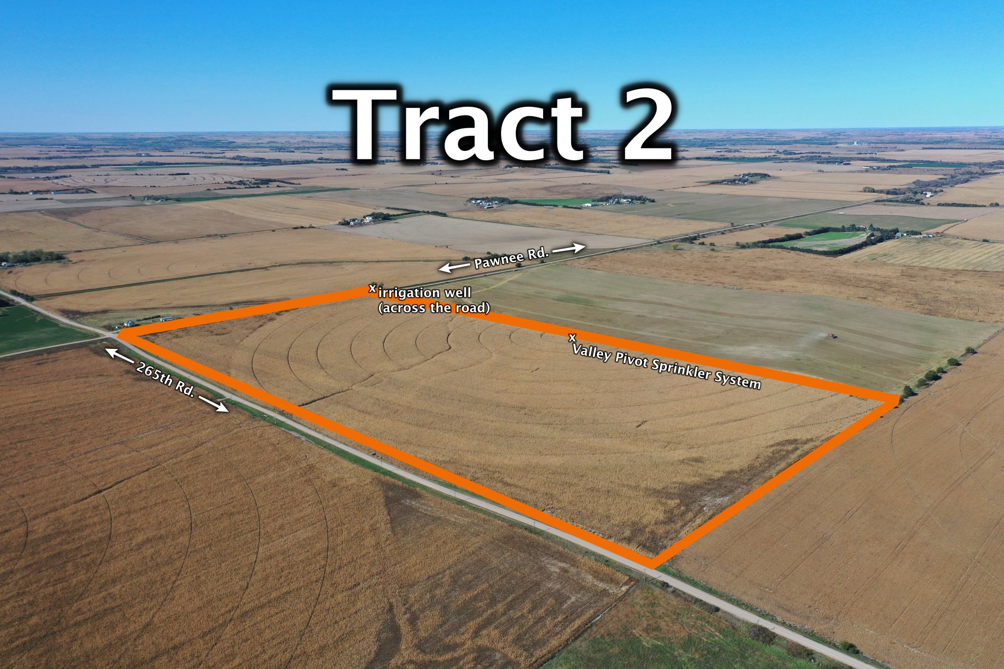
Location: From Ravenna, 6 miles south on Ravenna Rd. and 4 miles east on 265th Rd. From the east edge of Gibbon, 12 miles north.
Legal Description: South Half of Southwest Quarter of Section 7, Township 11 North, Range 13 West of the 6th P.M., and .1 acre well site along the east edge of the Southeast Quarter of Section 12, Township 11 North, Range 14 West of the 6th P.M., Buffalo County, Nebraska
About the Land: 77.03 Acres, more or less, based on Buffalo County Assessor’s records. Pivot irrigated cropland including a Valley 10 tower pivot system and 8” well with Origin 8L V-8 engine on natural gas. The property includes the irrigation well on the west side of Pawnee Rd.
Natural Resources District: The land is located in the Central Platte NRD and has certified irrigation rights for 60.6 acres.
Farm Service Agency: Total Cropland – est. 73.95 acres, Corn Base – est. 27.7 acres with a 141 bu. PLC yield, Soybeans Base – est. 18 acres with a 44 bu. PLC yield, Wheat Base – est. 4.5 acres with a 38 bu. PLC yield
Well Data: (per registration) G-147947, Feb. 1982, 260ft. deep, 46ft. static water level, 165ft. pumping level, 8” pump column, 1,050 GPM
2024 Taxes: $ 2,890.26